| Date: | Sunday 27 November 2022 |
| Time: | 17:29 |
| Type: |  Mooney M20J 201 |
| Owner/operator: | MFC Corp |
| Registration: | N201RF |
| MSN: | 24-0135 |
| Total airframe hrs: | 4437 hours |
| Fatalities: | Fatalities: 0 / Occupants: 2 |
| Other fatalities: | 0 |
| Aircraft damage: | Substantial |
| Category: | Accident |
| Location: | near Gaithersburg-Montgomery County Airport (GAI/KGAI), MD -
 United States of America United States of America
|
| Phase: | Approach |
| Nature: | Private |
| Departure airport: | White Plains-Westchester County Airport, NY (HPN/KHPN) |
| Gaithersburg-Montgomery County Airport, MD (GAI/KGAI) | |
| Investigating agency: | NTSB |
| Confidence Rating: |
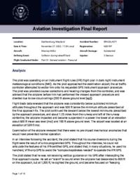
On November 27, 2022, at 1729 eastern standard time, a Mooney M20J, N201RF, was substantially damaged when it was involved in an accident near Gaithersburg, Maryland. The private pilot and passenger were seriously injured. The airplane was operated as a Title 14 Code of Federal Regulations (CFR) Part 91 personal flight.
The pilot was operating on an instrument flight rules (IFR) flight plan in dark night instrument meteorological conditions (IMC). As the pilot approached the destination airport, the air traffic controller attempted to vector him onto his requested GPS instrument approach procedure. The pilot was provided course corrections and heading changes from the controller, and was advised that the airplane before him had performed the missed approach procedure and diverted due to low cloud ceilings (200 ft above ground level [agl]).
Flight track data revealed that the airplane was consistently below published minimum altitudes throughout the approach and was 500 ft below the minimum altitude prescribed at the final approach fix. The pilot continued the descent below the lowest minimums prescribed by the approach procedure, and about 1.25 miles from the runway and left of the runway centerline, the airplane impacted and became suspended in a power line tower at an elevation about 600 ft mean sea level (msl) and 100 ft above ground level. The airport was located at an elevation of 539 ft msl.
Examination of the airplane revealed that there were no pre-impact mechanical anomalies that would have prevented normal operation.
In an interview following the accident, the pilot stated that his course diversions during the flight were the result of a mis-programmed GPS. Throughout the interview, he could not articulate the features of his IFR-certified GPS, and stated that, in many situations, he used his handheld, VFR-only GPS to avoid the “complex keystrokes needed” to operate the IFR GPS
The pilot stated that he was not receiving vertical guidance on his GPS after intercepting the final approach course. He set an “alarm” to sound when the airplane had descended to 800 ft on the approach, but at 1,200 ft, he sighted the ground, and became focused on “keeping contact with the ground through the side window” and “pulling the airport out of the soup.” The pilot stated that he was familiar with the powerlines that he impacted and believed that he was beyond them.
The lowest altitude allowed by the approach procedure was 789 ft msl, or 269 ft agl. However, this altitude was for an approach category that provided both lateral and vertical course guidance, and the pilot stated that he was not receiving vertical guidance. Whether the lack of vertical guidance was the result of the pilot’s mis-programming of the approach procedure or because he was referring to his VFR-only GPS for guidance was not determined. The lowest altitude allowed for an approach with only lateral guidance was 980 ft msl, or 460 ft agl.
Based on the available information, the pilot became preoccupied with attempting to visually locate the runway and failed to maintain an effective scan of his instruments, which resulted in his descent below minimums, lateral deviation off the approach course, and collision with powerlines.
Probable Cause: The pilot’s visual flight below published altitude minimums, which resulted in collision with a powerline tower structure.
 |
|
https://www.wsls.com/news/national/2022/11/28/plane-caught-in-power-lines-after-crash-2-occupants-unhurt/
https://www.cbsnews.com/baltimore/news/pilot-passenger-trapped-hundred-feet-in-air-after-small-plane-crashed-into-powerlines-in-montgomery-co/
https://www.wbaltv.com/article/no-power-electricity-outage-montgomery-county/42078097
https://data.ntsb.gov/Docket?ProjectID=106368
https://registry.faa.gov/AircraftInquiry/Search/NNumberResult?nNumberTxt=201RF
https://globe.adsbexchange.com/?icao=a19737&lat=39.185&lon=-77.192&zoom=15.0&showTrace=2022-11-27&leg=2
https://flightaware.com/live/flight/N201RF
https://flightaware.com/resources/airport/KGAI/IAP/RNAV+GPS+RWY+14 (Approach Plate)
https://cdn.jetphotos.com/full/6/57163_1590508723.jpg (photo)
Update - Gaithersburg, Maryland, @MontgomeryCoMD small plane into powerlines & tower plow, suspended about 100 feet in the air, two persons on board uninjured at this time, @mcfrs on scene, Widespread power outages, some roads closed in area, https://t.co/VRLGfpyFaA pic.twitter.com/3iCMW0v94j
— Pete Piringer (@mcfrsPIO) November 27, 2022
📹 Courtesy
— FL360aero (@fl360aero) November 28, 2022
Shane B. Murphy @shanermurph pic.twitter.com/RLY6Y4AGzP
Occupants are safe and waiting to be rescued. Outage Summary , Total Customers Affected - 80,922 pic.twitter.com/e9Dp1f3Qzc
— FL360aero (@fl360aero) November 28, 2022
A small plane carrying two people got stuck in power lines in the United States.
— Sky News (@SkyNews) November 28, 2022
Fire crews said the plane was stuck about 100 feet above the ground in Gaithersburg, Maryland.
Both passengers were taken to hospital with serious injuries.
More videos: https://t.co/8xyWy1V0ro pic.twitter.com/WMx73W7yzS
Here's a new, up-close look at the plane now on the ground #Gaithersburg @nbcwashington pic.twitter.com/8rmfJEN1UY
— Michael Pegram (@MichaelPNews) November 28, 2022
| Date/time | Contributor | Updates |
|---|---|---|
| 20-Jun-2024 20:00 | Captain Adam | Updated [Source, Embed code, Narrative, Accident report] |


 ©2024 Flight Safety Foundation